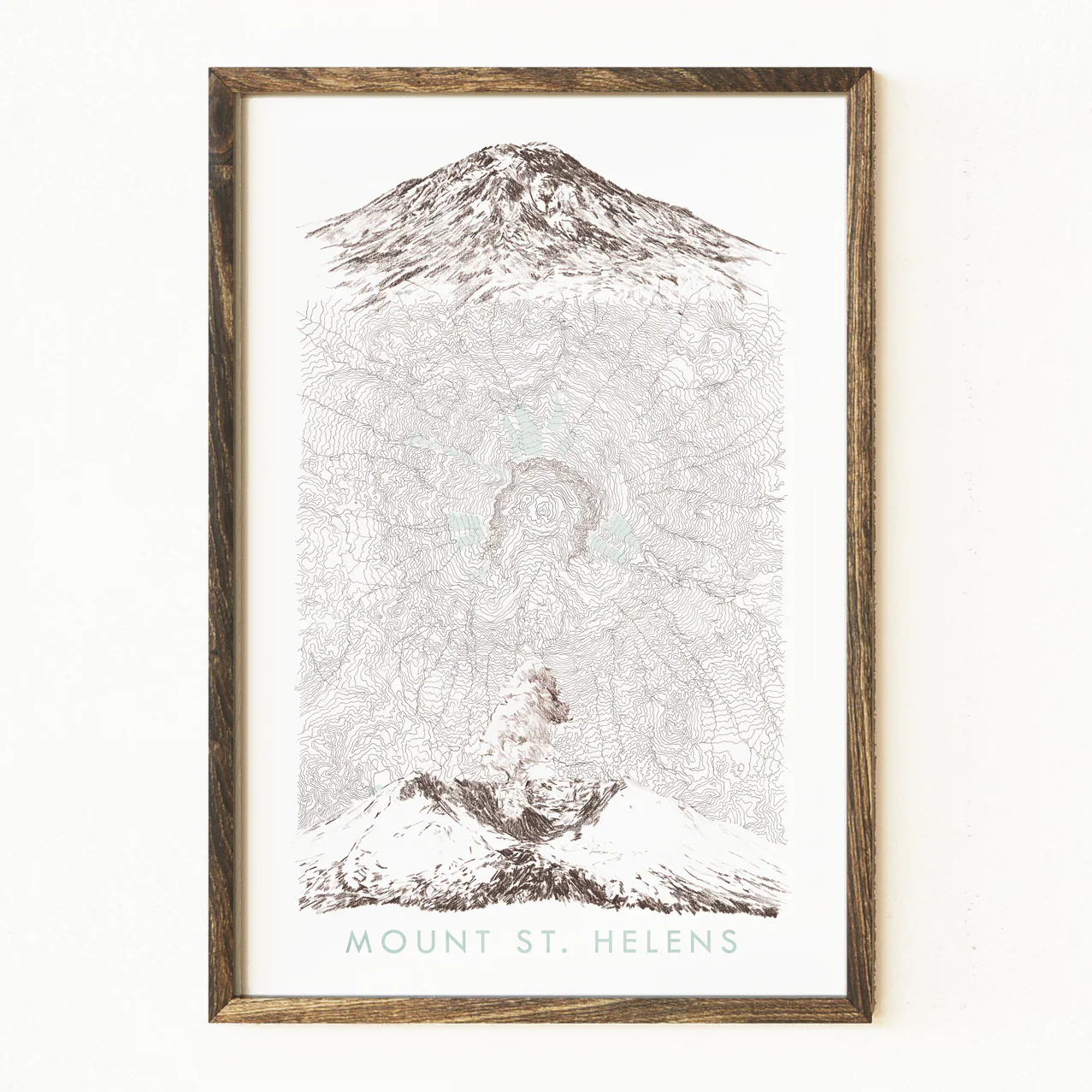
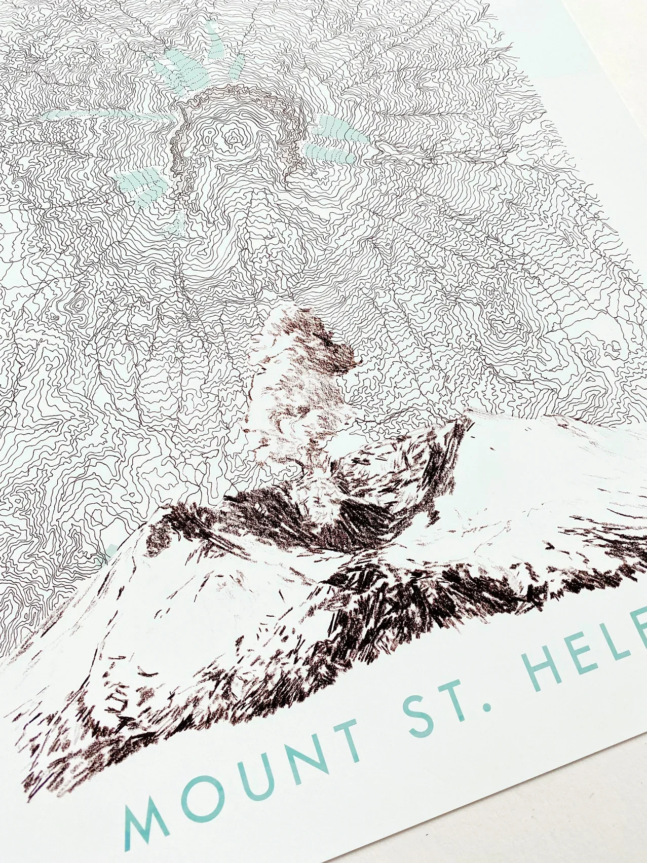
Turn of the Centuries - Mount St Helens Washington Topographical Map + Mountain Sketches
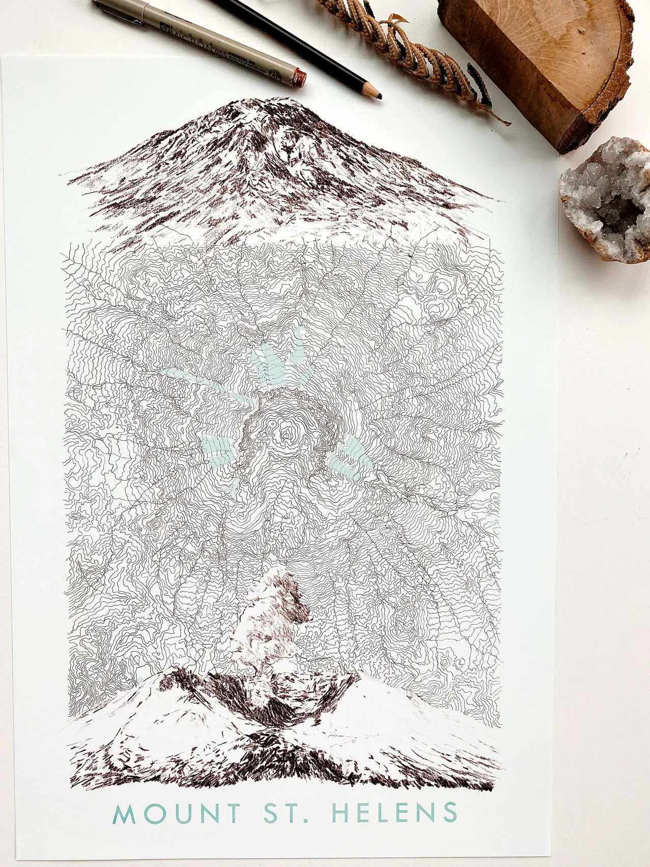
MOUNT ST. HELENS, Washington - before the 1980 eruption and after.
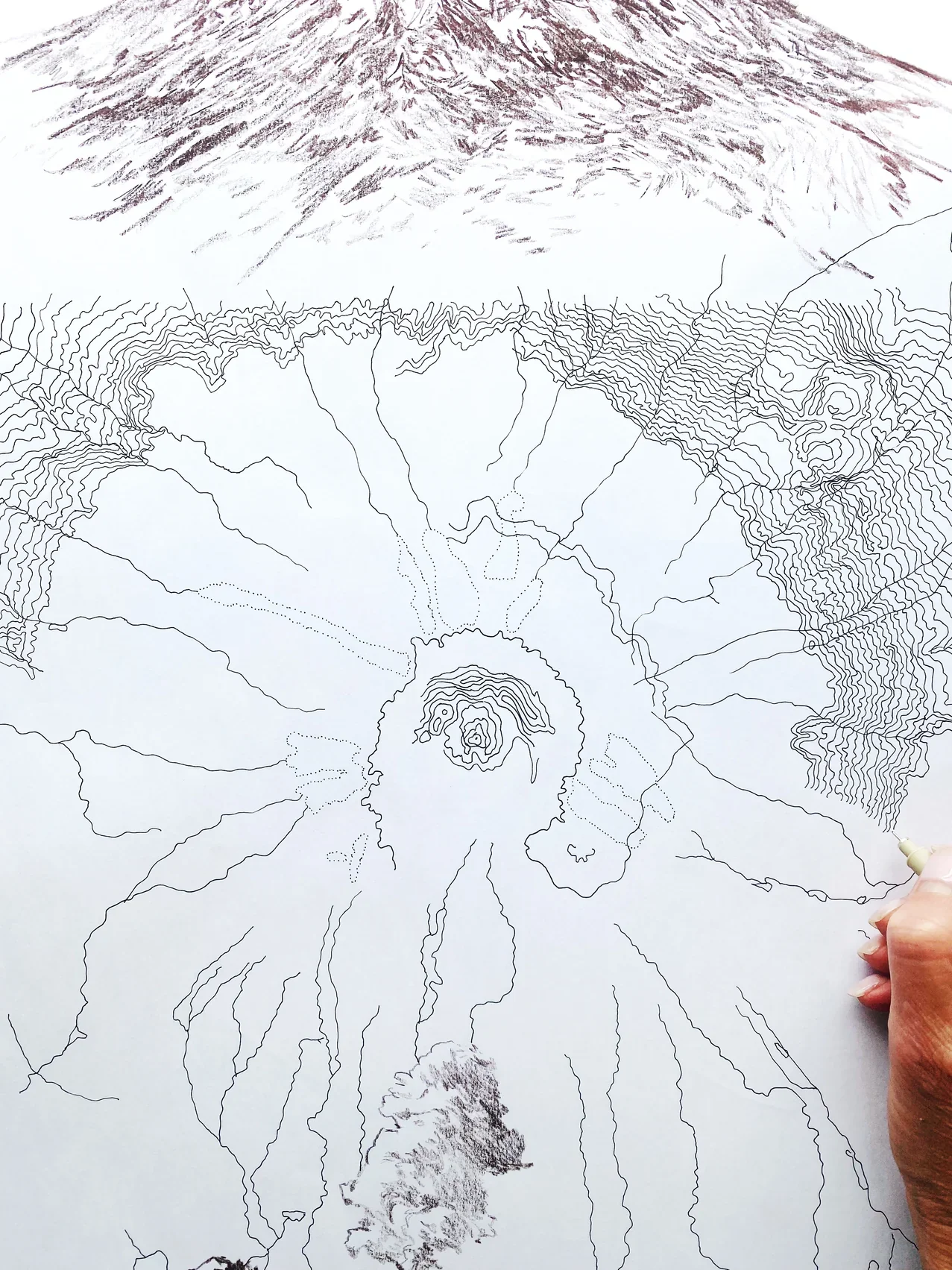
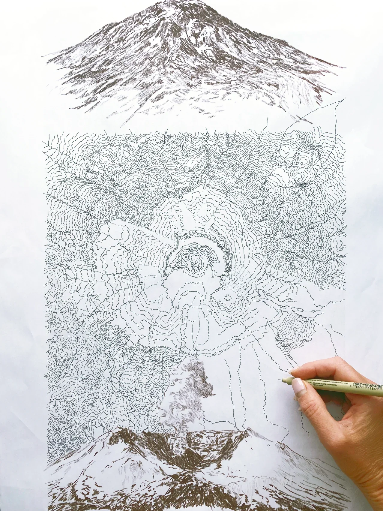
Turn of the Centuries hand-drawn Map depicts the unique topography of the mountain, after eruption, with a sketch of the mountain profile pre-1980 at the top pf the topographical map and a sketch below of its post-eruption form - complete with smoke/ash.
Drawings are brown. Glaciers and Lakes are pale blue.
Product Information
Product Information
Shipping & Returns
Shipping & Returns
Description
MOUNT ST. HELENS, Washington - before the 1980 eruption and after.
Turn of the Centuries hand-drawn Map depicts the unique topography of the mountain, after eruption, with a sketch of the mountain profile pre-1980 at the top pf the topographical map and a sketch below of its post-eruption form - complete with smoke/ash.
Drawings are brown. Glaciers and Lakes are pale blue.